Loch Katrine

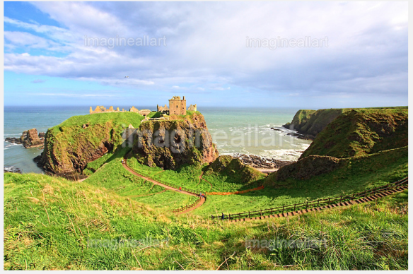
Loch Katrine is a freshwater loch in the district of Stirling, Scotland. It is a popular destination for tourists and day visitors from Glasgow and other nearby towns. The loch derives its name from the term cateran from the Gaelic ceathairne, a collective word meaning cattle thief or possibly peasantry. Historically this referred to a band of fighting men of a clan; hence the term applied to marauders or cattle-lifters, the most notorious of whom was Rob Roy MacGregor who was born at Glengyle House at the northern end of the Loch.

It is the fictional setting of Sir Walter Scott’s poem The Lady of the Lake and of the subsequent opera by Giachino Rossini La donna del lago. Loch Katrine is owned by Scottish Water and is the primary water reservoir for much of the city of Glasgow and its surrounding areas.
The main access points for Loch Katrine are either via TrossachsPier at the loch’s eastern end or Stronachlachar (Gaelic
Sròn a’ Chlachair “the headland of the stonemason”) towards the western end of the loch. Trossachs Pier essentially consists of a parking space, pier, gift shop and cafe (Katrine Cafe) which are open from the first to the last sailing of the cruise boats, (normally 6pm).

On the northern shore are the Brenchoile hunting lodge and the farms Letter (Gaelic: Leitir), Edra (Gaelic: Eatarra “between them”), Strone (Gaelic: An t-Sròn “the nose”), Coilachra, Portnellan (Gaelic: Port an Eilein “port of the island”) and Glengyle (Gaelic: Gleann Goill “glen of a lowlander”), on the southern are The Dhu (Gaelic: An Dubh “the black”) at the western end of the loch, Stronachlachar, the Royal Cottage, Culligart and Glasahoile (Gaelic: Glas-choille “greywood”). The roads and paths do not circle the loch completely, as the southern road stops at Glasahoile.

There are several small islands in Loch Katrine such as Ellen’s Isle (Gaelic: An t-Eilean Molach “the shingly isle”), the Black Isle and Factor’s Island (Gaelic: Eilean a’ Bhàillidh).

Queensferry

Queensferry, also called South Queensferry or simply “The Ferry”, is a town to the west of Edinburgh, Scotland. Until 1975 it was a Royal Burgh in the county of West Lothian. Queensferry is referred to as South Queensferry in order to distinguish it from North Queensferry. Its population at the 2011 census was 9,026 based on the 2010 definition of the locality.

There were ferries at Queensferry until 1964 when the Forth Road Bridge was opened. Ferry services continue to run from the harbour to the islands within the Firth of Forth, including Inchcolm.
A local fair dates from the 12th century. The modern fair, dating from the 1930s, takes place each August and includes the crowning of a local school-girl as the Ferry Fair Queen, a procession of floats, pipe bands, and competitive events such as the Boundary Race. The Fair also has a dedicated radio station, Jubilee1, which in May 2007 was awarded a licence to evolve into a full Public Service Community Station for North and South Queensferry.

Queensferry hosts the strange annual procession of the Burry Man during the Ferry Fair. This unique pagan-like cultural event is over three hundred years old, but its true origins are unknown. The name “Burry Man” almost certainly derives from the hooked fruits of the Burdock plant – burrs – which serve as the central feature of his dress, although some have suggested that it is a corruption of “Burgh Man”, since the town was formerly a royal burgh.

St Mary’s Episcopal Church also known as the Priory Church is the town’s oldest building, built for the Carmelite Order of friars in the 1450s. It is the only medieval Carmelite church still in use in the British Isles.

Stonehaven

Stonehaven is a town in Aberdeenshire, Scotland. It lies on Scotland’s northeast coast and had a population of 9,577 in 2001 census.

As the old county town of Kincardineshire, Stonehaven grew around an Iron Age fishing village, now the “Auld Toon” (“old town”), and expanded inland from the seaside. As late as the 16th century, old maps indicate the town was called Stonehyve, Stonehive,Pont also adding the alternative Duniness. It is known informally to locals as Stoney.

Dunnottar Castle, Stonehaven, Scotland, UK

                                   Dunnottar Castle, Stonehaven, Scotland, UK

Stonehaven is the site of prehistoric events as witnessed by finds at Fetteresso Castle and neolithic pottery excavations from the Spurryhillock area. Originally the settlement of Stonehaven grew and prospered and was known as Kilwhang. With ‘Kil’ meaning hill and ‘whang’ the name, or sound of a whip, possibly, the name is derived from the cliffs above the original settlement and the sound of wind whistling around their meagre shelters.

Stonehaven is 15 miles south of Aberdeen in a sheltered position on Stonehaven Baybetween the Carron Water and the Cowie Water. Stonehaven lies adjacent to a deeply indented bay surrounded on three sides by higher land between Downie Point and Garron Point.

Stonehaven has grown rapidly since the oil boom in Aberdeen. The increasing demand for new, middle-class housing has seen four new estates being appended to the town, creating an expanse of suburbs and Stonehaven has been bypassed since 1984.

Because of its location at the confluence between two rivers, Stonehaven is prone to flooding following heavy rain.

At present day the town’s primary industries are marine services and tourism, with Dunnottar Castle, a local landmark, bringing in a large number of tourists every year. Dunnottar Castle is regularly used in promotional material by the Scottish tourism industry; in addition, it was used in the 1990 movie Hamlet, and appeared as a featured desktop background in the UK edition of Microsoft Windows 7. Another attractive feature of the town is the long beach facing the North Sea, with large cliffs at either end sheltering small rock pools and inlets. It is also famous for its olympic-sized outdoor swimming pool, which is heated and filled with a mixture of tap water and filtered seawater. The local harbour features the Tolbooth, the town’s small museum of local heritage.

Luss

Luss is a village in Argyll & Bute, Scotland, on the west bank of Loch LomondHistorically in the County of Dunbarton, its original name is Clachan dubh, or ‘dark village’. Ben Lomond, the most southerly Munro, dominates the view north over the loch, and the Luss Hills rise to the west of the village.

Saint Kessog brought Christianity to Luss at some uncertain date in the ‘Dark Ages’. A number of early medieval and medieval monuments survive in the present churchyard, including simple cross-slabs which may date to as early as the 7th century AD, and a hogback grave-cover of the 11th century. A well-preserved late medieval effigy of abishop is preserved within the modern church.

Old Parish Church, Luss, Scotland

Old Parish Church, Luss, Scotland

The present Church of Scotland place of worship was built in 1875 bySir James Colquhoun, in memory of his father who had drowned in the loch in December 1873. The church is noted for its online services as well as for holding over one hundred weddings per year, most from outside the parish. Luss is the ancestral home of Clan Colquhoun.

Nowadays Luss is a conservation village, with a bypass carrying the busy A82 trunk road. Many of Luss’ cottages have been described as picturesque. The village has a kiltmaker and a bagpipe works. In recent years, Luss became famous as a result of being the main outdoor location for the Scottish Television drama series Take the High Road. Although the programme is no longer made, some in Luss remain proud of the connection: its fictional name, ‘Glendarroch,’ is used for some buildings.

Loch Lomond and Luss , Scotland

Loch Lomond and Luss , Scotland

About a mile south of the village, in a cove at Aldochlay, is a small figure on a stone plinth. A contemporary legendevolved that it is a memorial to a child drowned in the loch, but it was in fact erected in 1890 by a local stonemason, who found the statue in a London scrapyard. ‘Wee Peter’, as he is locally known, was moved to the site after a brief spell near the railway, and has remained there ever since.

The village hosts a water taxi service to Balloch, at the south of the loch, allowing visitors to transfer onwards to Glasgow by train or visit its shopping centre, Lomond Shores. Luss Pier is a popular starting point for boat trips on the loch.
The Loch Lomond Golf Club, which was for a number of years the site of the Barclays Scottish Open, is within the village’s borders.

See more images of Luss

Helensburgh

Helensburgh is a town in Argyll and Bute, Scotland. It lies on the north shore of the Firth of Clydeand the eastern shore of the entrance to the GarelochHelensburgh was formerly in Dumbarton District, but was re-allocated under local government reorganisation in 1996. Prior to 1975 it was part of the former Dunbartonshire.

Helensburgh, Scotland

Streets of  Helensburgh on a sunny beautiful day in July, Scotland, United Kingdom 

Helensburgh was founded in 1776 when Sir James Colquhoun of Luss built spa baths on the site of Ardencaple Castle, which dated back to about 1600. He then had the seaside resort town constructed to the east of the spa on a formal layout in the style of Edinburgh New Town, and named it after his wife Helen. A ferry service he arranged across the Firth of Clyde to Greenock was successful in attracting residents who could commute from jobs there to attractive homes in the new town. Helensburgh became a favourite place of residence for shipping tycoons and tobacco merchants from Glasgow. At one point the small town had one quarter of Britain’s millionaires living there.

Helensburgh born coal miner Charles Harper emigrated to New South Wales (now a state of Australia) and became the first manager of the Metropolitan Coal Company before being killed in a mine accident in 1887. In that year, the company took over the mining lease on an area south of Sydney known as Camp Creek. When the coal mine opened the following year, the town was named Helensburgh, possibly named after his birthplace or after his daughter Helen. The two Helensburghs are now sister cities.

Helensburgh today acts as a commuter town for nearby Glasgow, with a population at the 2001 census of 14,626, and also serves as a main shopping centre for the area and for tourists attracted to the seaside resort. Helensburgh is also influenced by the presence of theClyde Naval Base at Faslane on the Gare Loch, a major local employer. The town is a popular destination for day trippers.

The seafront has an indoor swimming pool, an esplanade walk, a range of shops, cafes and pubs, and sailing facilities including Helensburgh Sailing Club. At Rhu, just beyond the town boundary, there is a marina.

The streets are built on a gentle slope rising to the north east, and at the brow of the hill a golf club has views looking south out over the town to the Clyde, and to the north across nearby Loch Lomond to the Trossachs hills.

Helensburgh is home to a number of annual events, with the local branch of Round Table running an annual fireworks display on Guy Fawkes Night and hosting a Real Ale Festival at the Sailing Club.

See more images of Helensburgh