Dunure Castle

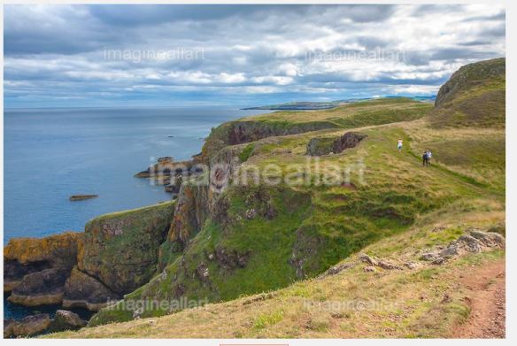
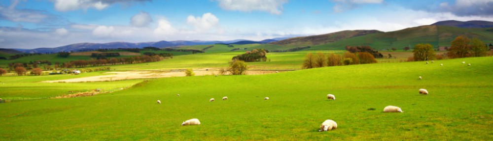
Ayrshire is one of my favourite destinations and I strongly recommend visiting the ruins of the castle and Ayrshire in general. When I saw this very old castle for the first time and the place itself I was very impressed. The beautiful beach is full of rocks and there is also a tiny harbour. Additionally, the landscape on the way to Ayrshire is stunning. The best time to come is in the early morning on Spring or Summer day, of course I mean sunny day, which is not that easy in Scotland but to make an effort and get up in the early morning to get there, is worthwhile. The light of the rising sun seen on the fields and hills with the sheep and the sea behind them is breathtaking. I was there many times but only once in the early morning and that was the best time ever.

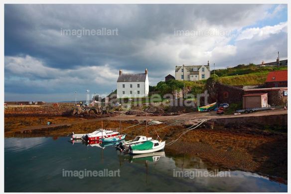
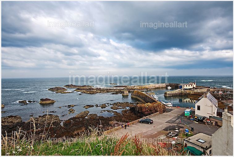
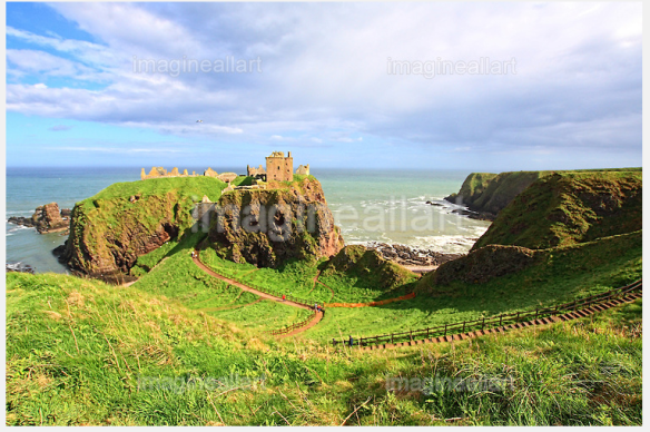
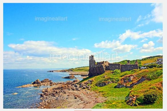
Dunure Castle is located on the west coast of Scotland, in South Ayrshire, about 5 miles south of Ayr and close to the village of Dunure. Today the castle stands in ruins on a rocky promontory on the Carrick coast, overlooking the small harbour of Dunure.

The site dates from the late 13th century; the earliest charter for the lands dating from 1256, but the remains of the building are of 15th- and 16th-century origin. One tradition is that the castle was built by the Danes and another states that the Mackinnons held the castle from Alexander III as a reward for their valour at the Battle of Largs.
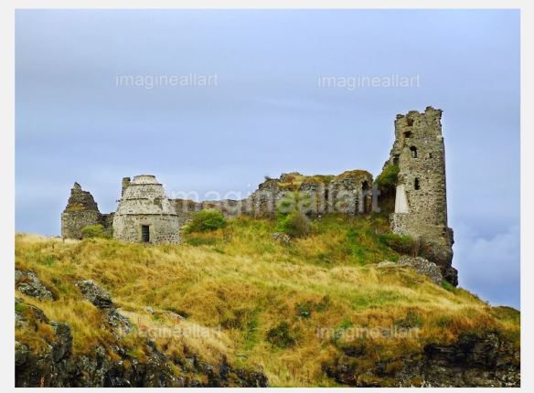
Dunure Castle

Dunure Castle

The castle is the point of origin of the Kennedys of Carrick, who once ruled over much of south western Scotland and were granted the lands in 1357. Sir James Balfour described Dunure as a grate and pleasand stronge housse, the most ancient habitation of the surname of Kennedy, Lairds of Dunure, now Earles of Cassiles.

The Celtic name Dunure or Dunoure is said to derive from the “hill” or “fort of the yew tree”.

The castle consisted of two distinct parts; a keep of an irregular shape on the top of a precipitous rock and other buildings at a lower level. The keep walls are about five feet thick and the vaults on the basement are well preserved, however most of the superstructure is entirely demolished. The keep represents the original castle, much altered. The central portion of the castle may be 15th century and was intended to form a defence to the access into the keep. The additional buildings are of a later date and contain two kitchens on the ground level, one for the castle and the other for the retainers. To the north-east stands a detached wall which may have led to a gateway. A drawbridge may have stood nearby and the chapel may have been located against the thick wall of the central part of the castle. A moat or fosse protected the approach and a wall may have also existed.

Beneath the castle is a cavern, called the Browney’s Cave which may have been a sally-port; a secret tunnel leading to the castle.

Ruins of Dunure Castle, Scotland

Ruins of Dunure Castle, Scotland

In 1429 a meeting took place at Dunure between James Campbell, representing King James I of Scotland and John Mor MacDonald, representing the Lord of the Isles. Violence broke out and MacDonald was killed. James I’s efforts to contain the outrage of the Lords of the Isles by executing Campbell did not prevent a subsequent uprising by them. For three days from 4 August 1563, Mary, Queen of Scots, stayed at Dunure Castle on her Royal tour down the west coast to Glenluce Abbey then on to Whithorn Priory. She was the guest of Gilbert Kennedy, the 4th Earl of Cassilis.


The castle has been excavated and consolidated, making safe the public access to the area. The castle dominates the Kennedy Park, which has a number of facilities for visitors. There are also said to be secret Ley tunnels which connect Dunure Castle to Greenan Castle further north.

Loch Katrine

Loch Katrine is a freshwater loch in the district of Stirling, Scotland. It is a popular destination for tourists and day visitors from Glasgow and other nearby towns. The loch derives its name from the term cateran from the Gaelic ceathairne, a collective word meaning cattle thief or possibly peasantry. Historically this referred to a band of fighting men of a clan; hence the term applied to marauders or cattle-lifters, the most notorious of whom was Rob Roy MacGregor who was born at Glengyle House at the northern end of the Loch.

It is the fictional setting of Sir Walter Scott’s poem The Lady of the Lake and of the subsequent opera by Giachino Rossini La donna del lago. Loch Katrine is owned by Scottish Water and is the primary water reservoir for much of the city of Glasgow and its surrounding areas.
The main access points for Loch Katrine are either via TrossachsPier at the loch’s eastern end or Stronachlachar (Gaelic
Sròn a’ Chlachair “the headland of the stonemason”) towards the western end of the loch. Trossachs Pier essentially consists of a parking space, pier, gift shop and cafe (Katrine Cafe) which are open from the first to the last sailing of the cruise boats, (normally 6pm).

On the northern shore are the Brenchoile hunting lodge and the farms Letter (Gaelic: Leitir), Edra (Gaelic: Eatarra “between them”), Strone (Gaelic: An t-Sròn “the nose”), Coilachra, Portnellan (Gaelic: Port an Eilein “port of the island”) and Glengyle (Gaelic: Gleann Goill “glen of a lowlander”), on the southern are The Dhu (Gaelic: An Dubh “the black”) at the western end of the loch, Stronachlachar, the Royal Cottage, Culligart and Glasahoile (Gaelic: Glas-choille “greywood”). The roads and paths do not circle the loch completely, as the southern road stops at Glasahoile.

There are several small islands in Loch Katrine such as Ellen’s Isle (Gaelic: An t-Eilean Molach “the shingly isle”), the Black Isle and Factor’s Island (Gaelic: Eilean a’ Bhàillidh).

St Abbs, Berwickshire, Scottish Borders

St Abbs is an exceptional, tiny but beautiful and picturesque fishing village historically known as Coldingham Shore, located on the south east coast of Scotland in the Berwickshire area of the Scottish Borders. It is not far from Eyemouth and it’s worth seeing if you happen to be in that region.

St Abbs village in Scotland

St Abbs village in Scotland

st abbs2 The village was originally known as Coldingham Shore, the name was changed in the 1890s to St Abbs. The new name was derived from St Abb’s Head, a rocky promontory located to the north of the village, itself named after St. Aebbe.

St Abbs Head, rocky promontory at the village of St. Abbs, Berwickshire, Scottish Borders.

St Abbs Head, rocky promontory at the village of St. Abbs, Berwickshire, Scottish Borders.

St Abbs was originally called Coldingham Shore. Prior to any buildings the fishermen who worked their boats from the beach resided at Fisher’s Brae in Coldingham.These fishermen had to carry their fishing gear the one and a half miles down a path. The path is now known as the Creel Path. The first building in St Abbs was constructed about the middle of the 18th century followed later by a row of 5 cottages. This first row of houses where constructed in a traditional Scottish style with a central fire and a wide chimney. The walls were constructed of “Clat and Clay” a framework of wood interlaced with straw and daubed over with moist clay. The village was renamed at the end of the 19th century by the then Laird Mr Andrew Usher, to its present title St Abbs. St Abbs is a popular site for Scuba Divers. The sea around the village is unusually clear, in contrast to the more silt-laden coastal waters further to the north or south. These clear waters and the spectacular underwater scenery resulted in Britain’s first Voluntary Marine Reserve being established at St Abbs. Shore diving to a depth of about 15 metres is possible from the rocks on the outside of the harbour wall. It is common for trainees to do initial sea dives here. The double archway at “Cathedral Rock” is just 50 metres from the shore. Several small, nearby rocky islands, such as “Big Green Carr”, “Broad Craig” and “Little Carr” are near to the harbour and easily can be circumnavigated underwater. March 2011 saw the opening of the latest addition to the many attractions of St Abbs in the form of the new St Abbs Visitor Centre. A beautiful, contemporary facility, it is located in the old village hall, perched precariously on a cliff edge. Built as a resource for both visitors and locals, the Centre offers free admission, interactive exhibits, library area, web access, stunning photographs and historical artefacts. It’s an ideal starting point to a visit to St Abbs, giving information on the history of the village, the geology and also the local flora and fauna visitors are likely to encounter. The position of the building offers a stunning 180 degree view from St Abbs Head all the way to the harbour and beyond. The St Abbs Visitor Centre is an independent Scottish charity.

Stonehaven

Stonehaven is a town in Aberdeenshire, Scotland. It lies on Scotland’s northeast coast and had a population of 9,577 in 2001 census.

As the old county town of Kincardineshire, Stonehaven grew around an Iron Age fishing village, now the “Auld Toon” (“old town”), and expanded inland from the seaside. As late as the 16th century, old maps indicate the town was called Stonehyve, Stonehive,Pont also adding the alternative Duniness. It is known informally to locals as Stoney.

Dunnottar Castle, Stonehaven, Scotland, UK

                                   Dunnottar Castle, Stonehaven, Scotland, UK

Stonehaven is the site of prehistoric events as witnessed by finds at Fetteresso Castle and neolithic pottery excavations from the Spurryhillock area. Originally the settlement of Stonehaven grew and prospered and was known as Kilwhang. With ‘Kil’ meaning hill and ‘whang’ the name, or sound of a whip, possibly, the name is derived from the cliffs above the original settlement and the sound of wind whistling around their meagre shelters.

Stonehaven is 15 miles south of Aberdeen in a sheltered position on Stonehaven Baybetween the Carron Water and the Cowie Water. Stonehaven lies adjacent to a deeply indented bay surrounded on three sides by higher land between Downie Point and Garron Point.

Stonehaven has grown rapidly since the oil boom in Aberdeen. The increasing demand for new, middle-class housing has seen four new estates being appended to the town, creating an expanse of suburbs and Stonehaven has been bypassed since 1984.

Because of its location at the confluence between two rivers, Stonehaven is prone to flooding following heavy rain.

At present day the town’s primary industries are marine services and tourism, with Dunnottar Castle, a local landmark, bringing in a large number of tourists every year. Dunnottar Castle is regularly used in promotional material by the Scottish tourism industry; in addition, it was used in the 1990 movie Hamlet, and appeared as a featured desktop background in the UK edition of Microsoft Windows 7. Another attractive feature of the town is the long beach facing the North Sea, with large cliffs at either end sheltering small rock pools and inlets. It is also famous for its olympic-sized outdoor swimming pool, which is heated and filled with a mixture of tap water and filtered seawater. The local harbour features the Tolbooth, the town’s small museum of local heritage.

Helensburgh

Helensburgh is a town in Argyll and Bute, Scotland. It lies on the north shore of the Firth of Clydeand the eastern shore of the entrance to the GarelochHelensburgh was formerly in Dumbarton District, but was re-allocated under local government reorganisation in 1996. Prior to 1975 it was part of the former Dunbartonshire.

Helensburgh, Scotland

Streets of  Helensburgh on a sunny beautiful day in July, Scotland, United Kingdom 

Helensburgh was founded in 1776 when Sir James Colquhoun of Luss built spa baths on the site of Ardencaple Castle, which dated back to about 1600. He then had the seaside resort town constructed to the east of the spa on a formal layout in the style of Edinburgh New Town, and named it after his wife Helen. A ferry service he arranged across the Firth of Clyde to Greenock was successful in attracting residents who could commute from jobs there to attractive homes in the new town. Helensburgh became a favourite place of residence for shipping tycoons and tobacco merchants from Glasgow. At one point the small town had one quarter of Britain’s millionaires living there.

Helensburgh born coal miner Charles Harper emigrated to New South Wales (now a state of Australia) and became the first manager of the Metropolitan Coal Company before being killed in a mine accident in 1887. In that year, the company took over the mining lease on an area south of Sydney known as Camp Creek. When the coal mine opened the following year, the town was named Helensburgh, possibly named after his birthplace or after his daughter Helen. The two Helensburghs are now sister cities.

Helensburgh today acts as a commuter town for nearby Glasgow, with a population at the 2001 census of 14,626, and also serves as a main shopping centre for the area and for tourists attracted to the seaside resort. Helensburgh is also influenced by the presence of theClyde Naval Base at Faslane on the Gare Loch, a major local employer. The town is a popular destination for day trippers.

The seafront has an indoor swimming pool, an esplanade walk, a range of shops, cafes and pubs, and sailing facilities including Helensburgh Sailing Club. At Rhu, just beyond the town boundary, there is a marina.

The streets are built on a gentle slope rising to the north east, and at the brow of the hill a golf club has views looking south out over the town to the Clyde, and to the north across nearby Loch Lomond to the Trossachs hills.

Helensburgh is home to a number of annual events, with the local branch of Round Table running an annual fireworks display on Guy Fawkes Night and hosting a Real Ale Festival at the Sailing Club.

See more images of Helensburgh 


Falkirk

Falkirk, town in the Central Lowlands of Scotland, historically within the county of Stirlingshire. It lies in the Forth Valley, almost midway between the two most populous cities of Scotland; north-west of Edinburgh and north-east of Glasgow.

Streets of Falkirk, Scotland

                                               Streets of Falkirk, Scotland

Falkirk had a resident population of 32,422 at the 2001 census. The population of the town had risen to 34,570 according to a 2008 estimate, making it the 20th most populous settlement in Scotland. Falkirk is the main town and administrative centre of theFalkirk council area, which has an overall population of 156,800 and inholds the nearby towns of Grangemouth,Bo’ness,Denny,Larbert and Stenhousemuir.

The town lies at the junction of the Forth and Clyde Canal and the Union Canal, a location which proved key to the growth of Falkirk as a centre of heavy industry during the Industrial Revolution. In the 18th and 19th centuries Falkirk was at the centre of the iron and steel industry, underpinned by the Carron Company in the nearby village of Carron. The company was responsible for making carronades for the Royal Navy and also later many pillar boxes. In the last 50 years heavy industry has waned, and the economy of the town relies increasingly on retail and tourism. Despite this, Falkirk remains the home of many international companies.

Falkirk Park

                                   Callendar House and Park in Falkirk

Attractions in and around Falkirk include the Falkirk Wheel, Callendar House and Park and remnants of the Antonine Wall. Soon to be a feature of the town is the Falkirk Helix, a new recreational area with walk and cycle paths with the main attraction being a new boat lift and extension to the Forth and Clyde Canal. In a 2011 poll conducted by STV, it was voted as Scotland’s most beautiful town, ahead of Perth and Stirling in 2nd and 3rd place respectively.

Architecture of Falkirk

Architecture of Falkirk

Falkirk hosted a national arts festival which ran in Callendar Park from 2000-2009 called Big In Falkirk. After its inception in 2000, the festival won Scottish Thistle Award for Events & Festivals in 2005. Consisting of a free weekend of events, the festival was one of the largest cultural events in Scotland, attracting over 100,000 people. Hosted in Falkirk’s historical Callendar Park, with Callendar House as the focal point, the entertainment featured a wide variety of outdoor theatre, pyrotechnic displays, arts, comedy and big name music acts, alongside activities for all ages.


Stirling, ‘Brave Heart of Scotland’

Stirling is a city in central Scotlandclustered around a large fortress and medieval old-town. Stirling is the administrative centre for the Stirling council area, and is traditionally the county town of Stirlingshire.
The city is located several kilometres to the west of the mouth of the
River Forth. Historically it was strategically important as the “Gateway to the Highlands”, with its position near the Highland Boundary Fault between the Scottish Lowlands and Highlands, indeed, it has been described as the brooch which clasps the Highlands and the Lowlands together.

Stirling Castle with Scotsmen

Stirling Castle with Scotsmen

Its historical position as the nearest crossing of the Forth to the river mouth meant that many of its visitors were in fact invaders. The beast of Stirling is the wolf, which it shares with Rome. According to legend, when Stirling was under attack from Viking invaders, a wolf howled, alerting the townspeople in time to save the town. It is also claimed that the last wolf in Scotland was killed in Stirling.

Once the capital of Scotland, Stirling contains the Great Hall (restored 1999) and the Renaissance Palace (restoration completed 2011) within the Castle that rivalled any building in Europe at the time. Stirling also has its medieval parish church, The Church of the Holy Rude, where King James VI was crowned King of Scots on 29 July 1567. The Holy Rude still functions as a living church with a service every Sunday.

Stirling is a centre for local government, higher education, retail, and industry. In 2012, the population of the City was 45,750. The wider Stirling council area has a population of 89,850. The majority of the population is located in its southeast corner, in the City of Stirling and in the surrounding area.

Streets of City of Stirling with W. Wallace statue at The Athenaeum, King Street

   Streets of City of Stirling with W. Wallace statue at The Athenaeum, King Street

One of the principal royal strongholds of the Kingdom of Scotland, Stirling was created a Royal burgh by King David in 1130, which it remained until 1975, when the burgh as an administrative unit was abolished.
In 2002, as part of
Queen Elizabeth II‘sGolden Jubilee, Stirling was granted city status.

Top attraction in Stirling is The National Wallace Monument (generally known as the Wallace Monument), a tower standing on the summit of Abbey Craig, a hilltop near Stiling. It commemorates Sir William Wallace, a 13th-century Scottish hero.

In 1996 Tom Church carved a statue of Wallace called “Freedom” and inspired by the film Braveheart. It has the face of Mel Gibson, the actor that played William Wallace in the film. Church leased the statue to Stirling Council, who in 1997 installed it in the car park of the visitor centre at the foot of the craig. The statue was deeply unpopular with local people and was regularly vandalised before being placed in a cage to prevent further damage.

Aberdeen, the Oil Capital of Europe

Aberdeen, is Scotland‘s third most populous city, one of Scotland’s 32 local government council areas and the United Kingdom’s 37th most populous built-up-area with an official population estimate of 220,420.

Nicknames include the Granite City, the Grey City and the Silver City with the Golden Sands. During the mid-18th to mid-20th centuries, Aberdeen’s buildings incorporated locally quarried grey granite, which can sparkle like silver due to its high mica content. Since the discovery of North Sea oil in the 1970s, other nicknames have been the Oil Capital of Europe or the Energy Capital of Europe. The area around Aberdeen has been settled since at least 8,000 years ago, when prehistoric villages lay around the mouths of the rivers Dee and Don. The city has a long, sandy coastline. Aberdeen received Royal Burgh status from David I of Scotland (1124–53), transforming the city economically. 

The city’s two universities, the University of Aberdeen, founded in 1495, and Robert Gordon University, which was awarded university status in 1992, make Aberdeen the educational centre of the north-east.
The traditional industries of fishing, paper-making, shipbuilding, and textiles have been overtaken by the oil industry and Aberdeen’s seaport. Aberdeen Heliport is one of the busiest commercial heliports
in the world and the seaport is the largest in the north-east of Scotland.

In 2012, Mercer named Aberdeen the 56th most liveable city in the World, as well as the fourth most liveable city in Britain. In 2012, HSBC named Aberdeen as a leading business hub and one of eight ‘super cities’ spearheading the UK’s economy, marking it as the only city in Scotland to receive this accolade.

Aberdeen has won the Britain in Bloom competition a record-breaking ten times, and hosts the Aberdeen International Youth Festival, a major international event which attracts up to 1000 of the most talented young performing arts companies

Aberdeen is home to a number of events and festivals including Aberdeen Jazz Festival Rootin’ Aboot (a folk and roots music event), Triptych, the University of Aberdeen‘s literature festival Wordand DanceLive, Scotland’s only Festival of contemporary dance, which is produced by the city’s Citymoves dance organisation.

The Aberdeen Student Show, performed annually without interruption since 1921, under the auspices of the Aberdeen Students’ Charities Campaign, is the longest-running of its kind in the United Kingdom. It is written, produced and performed by students and graduates of Aberdeen’s universities and higher education institutions. Since 1929—other than on a handful of occasions, it has been staged at His Majesty’s Theatre. The Student Show traditionally combines comedy and music, inspired by the North-East’s Doric dialect and humour.

National festivals which visited Aberdeen in 2012 included the British Science Festival in September, hosted by the University of Aberdeen but with events also taking place at Robert Gordon University and at other venues across the city. In February 2012 the University of Aberdeen also hosted the Inter Varsity Folk Dance Festival, the longest running folk festival in the United Kingdom.

Dundee, ‘One City, Many Discoveries’

Dundee is officially the City of Dundee, is the fourth-largest city in Scotland by population. At the 2011 census, it had a population density of 3,298 people per square kilometre, the second highest of any Scottish city. It lies within the eastern central Lowlands on the north bank of the Firth of Tay, which feeds into the North Sea.
The town developed into a burgh
in medieval times, and expanded rapidly in the 19th century largely due to the jute industry. This, along with its other major industries gave Dundee its epithet as city of “jute, jam and journalism”.

Today, Dundee is promoted as ‘One City, Many Discoveries’ in honour of Dundee’s history of scientific activities and of the RRS Discovery, Robert Falcon Scott‘s Antarctic exploration vessel, which was built in Dundee and is now berthed in the city harbour. Biomedical and technological industries have arrived since the 1980s, and the city now accounts for 10% of the United Kingdom’s digital-entertainment industry.
In December 2014; Dundee was named the first city in the United Kingdom to hold the UNESCO City of Design status by the United Nations.

Dundee has two universities- the University of Dundee and the Abertay University. In 2014 Dundee was recognised by the United Nations as the UK’s first UNESCO City of Design for its diverse contributions to fields including medical research, comics and video games.

Visitors wishing to orient themselves should consider taking a walk (or drive) up the Law, Dundee which offers a 360-degree uninterrupted view of Dundee, the Firth of Tay and the Tay Bridge, famously replacing the bridge demolished after the disaster of 1879, and the Tay Road Bridge.

Dundee’s principal concert auditorium, the Caird Hall (named after its benefactor, the jute baron James Key Caird) in the City Square regularly hosts the Royal Scottish National Orchestra. Various smaller venues host local and international musicians during Dundee’s annual Jazz, Guitar and Blues Festivals. The Dundee Contemporary Arts, which opened in 1999 in the city’s cultural quarter, is home to both an art gallery and art house cinema. Dundee is also known for The Dandy and The Beano– a long-running children’s comics.

Glasgow

Come to visit the City of Glasgow in Scotland, United Kingdom

Glasgow city

Glasgow,  George Square, Scotland. If you wish to see more images of Glasgow, click on the images and you will be taken to my photography website.

Glasgow is the largest city in Scotland, it’s situated on the River Clyde, in the Central Belt on the west coast of Scotland and is easily accessible by road, rail and air. Inhabitants of the city are referred to as Glaswegians.

Glasgow is one of Europe’s most vibrant and cosmopolitan cities. It boasts world famous art collections, the best shopping in the UK outside of London, first-class sports and leisure facilities, a vast array of restaurants and bars, and the most vibrant and exciting nightlife in Scotland. The city is home to Scottish Ballet, Scottish Opera and the Royal Scottish National Orchestra.

Lonely Planet describes Glasgow as ‘Scotland at its artsy, riotous, high-octane, good-time best’.

Just beyond the city itself lies some of Scotland’s most spectacular scenery – ancient castles, lochs, glens and miles of beautiful coastline. There are some of the best opportunities for walking, sailing, trout fishing and playing golf. Glasgow is also only 42 miles from Scotland’s capital, Edinburgh.

2 Short videos I recorded last summer in Glasgow

And this one below is the longer one but it is not mine, so depending how much time you have check the one you like.

I myself love this music and the drummers 🙂